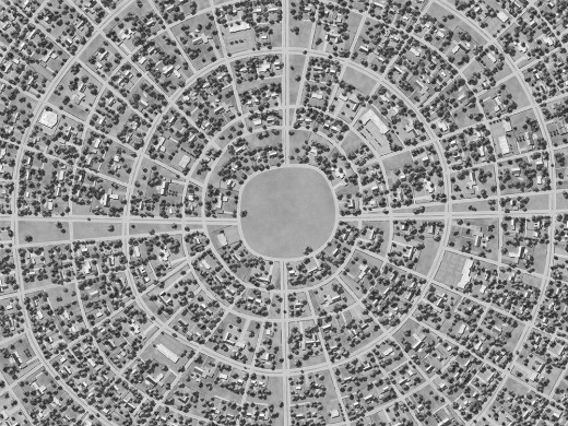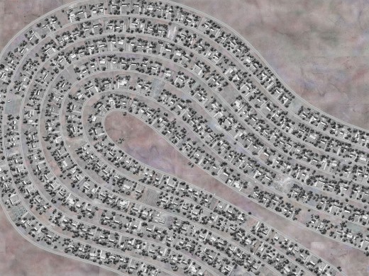
From PlannersWeb Editor Wayne Senville: Two years ago I saw an exhibit that included several of Ross Racine’s highly detailed, imaginative, aerial-photo like drawings. As Racine describes his process:
“My images of aerial views are totally fictional, although in the beginning I used aerial photographs as references for the overall appearance of the landscape. My process involves creating the artwork in two steps: first, drawing freehand directly with the computer, and second, printing the image on paper with an inkjet printer. These drawings do not contain photographs or scanned material. The works are completely drawn in Adobe Photoshop, with pen and tablet, aside from some preparatory work in Adobe Illustrator. … The process involves combining key elements from the techniques of drawing, collage, and printmaking with the assets of the virtual working environment.”
I recently received an announcement from Racine of two current exhibits of his work, one in Summit, New Jersey, the other in Brooklyn, New York. For details on his exhibitions.
More easy for most of you is to browse through the artwork Racine has posted online.
To give you a taste of his work, we’ve also posted three of his works on this page (click on the images to view them at larger size).

From an interview by Nora Herting, posted on the Proof of Concept blog:
“I want my images to inhabit a place that is in between a drawing and a photograph. … Many people do view my work as photographic, at least at first, because of the realism and the surface treatment. But I want my images to be fictions. There is some fictional element to all of the work.
Also I think they look like models of potential places. … What occurs in my pictures could be emblematic for society as a whole. We come in and clear the land and then plop down buildings and try to re-insert nature through a few planted trees. Nature is tamed in these images. But I want to avoid being more specific here because I want the viewer to draw his or her own conclusions. I prefer my image to work as a trigger, not a final statement.”

From an interview by Josh O’Conner of UrbanTimes:
“I actually use Google Earth and other satellite imagery as references and inspiration, since aerial photography is closer to my images than maps are. The general public’s increasing familiarity with aerial photography, thanks to its instant availability, makes the aerial view a vantage point more common than before in the popular imagination. Looking at things from above is now second nature to many people. The view from above facilitates a more synthetic idea of the world and the distance required for a reflective attitude. …”