Read an excerpt from this article below. You can download the full article by using the link at the end of the excerpt.
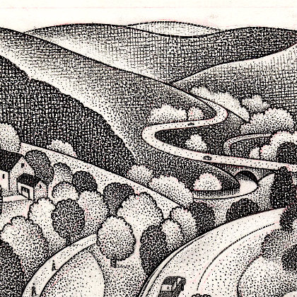
Whether it’s a state highway, a county road, or a frequently traveled local road, every town has main corridors that form the framework around which the community develops. The way these corridors look and function not only helps define a community, but has a large impact on our daily lives. Many planners, planning commissioners, and citizens have come to recognize that:
— too often our roadway corridors are given over to a hodgepodge of uses, with development sprawling out from town or village centers;
— the preservation of farmland and open spaces along the corridor are not always given much attention; and
— valued vistas and natural landscapes are often lost to scattered development.
There are alternatives to these common trends, but they require a fresh look at the landscapes of our roadway corridors and the ways we allow them to grow and develop.
Start with a Corridor Analysis
An essential first step in understanding a roadway corridor and planning for its future involves conducting a landscape analysis of the corridor. A landscape analysis will provide a solid base of information and understanding upon which to develop your comprehensive plan and zoning and subdivision regulations. This, in turn, will allow for better review of specific projects within the corridor. Landscape analyses can vary in detail and complexity, based on your commission’s time, funding, and level of assistance, but the essential steps are similar. Regardless of the level of sophistication an analysis is well worth the time and effort.
Before beginning your analysis you must first determine the extent of the focus area along your community’s main road corridor. If your corridor is a lengthy one you may need to begin with a portion of the corridor, rather than tackling the entire stretch. Start with some simple questions to help set your study boundaries:
— What is of most concern?
— Where are there features that the community particularly values or enjoys?
— Are there areas where large changes are imminent, such as road improvements or a major development?
— Are there physical features or lot lines that form a logical study area boundary?
These types of questions will help you define the area you are most interested in and the extent to which roads that connect to your main corridor are included. Don’t forget to also consider your capacity for the work, including funding, participants, and timeframe. Start with whatever you can manage well.
1. Hit the Road!
An effective — and often enjoyable — way to start a corridor landscape analysis is to gather your planning commission for a road trip along the route. Even though you may all travel the route frequently, you may not have taken a hard look at what’s really happening. Moreover, different people tend to notice different things while traveling. Find a vehicle that everyone can fit in. Prepare a list of questions to consider and distribute them ahead of the tour. The kinds of questions to ask might include:
— What do you notice that is key to the corridor?
— What do you like and dislike about the corridor and why?
— What is vulnerable? What, if it changes, would alter your perception of the corridor?
Don’t worry too much at this stage about in-depth discussions or detailed answers; the object is to get everyone thinking and to generate other questions that should be considered. Having this common experience of the corridor will serve your group well during the rest of the analysis — and even in the future if your commission reviews projects located within the corridor. …
The balance of the article covers:
2. Conduct an Inventory
3. Look for Patterns
4. Analyze Your Information
Making Use of What You’ve Learned:
1. Incorporating Corridor Objectives into the Comprehensive Plan
2. Regulatory Steps for Corridor Preservation: Zoning Districts and Uses; Overlay Districts; Dimensional and Site Standards; Subdivision Regulations; Utilities and Infrastructure; and Access Management
You must be logged in or a PlannersWeb member to download this PDF.