Ten Events That Shaped the 20th Century American City
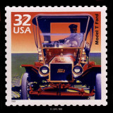
…key developments that shaped the 20th century American city. The article also includes numerous photos, plus sidebars on: tenement housing; the Model-T; the Triangle Fire; Dams; Levittown; and interstate highways. 1. 1847: The beginning of…