graphic illustration of a city map

A Primer on Maps:

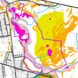
…introduce you to geographic information systems (GIS), a rapidly expanding technology that integrates computer maps and database management systems (DBMS) to facilitate various types of spatial analysis. … [Editor’s Note: see also Thomas Millette’s more…

Planning ABC's illustration

M is for Maps

…regarding alternative land developments at specific mapped locations. McHarg’s approach to the analysis of development opportunities and constraints served as another precursor to the “geographic information systems” (GIS) of today. Editor’s note: see also Thomas

GIS map used to evaluate zoning changes in a small town.

GIS & Planning

Read an excerpt from this article below. You can download the full article by using the link at the end of the excerpt. Since planners were among the earliest adopters of GIS, there is no…