
Listening to a recent webinar on Transportation Performance Measures, 1 I was reminded of the Rodgers and Hammerstein song from Oklahoma, “The Farmer and the Cowman.”
“The farmer and the cowman should be friends,
Oh, the farmer and the cowman should be friends.
One man likes to push a plough, the other likes to chase a cow,
But that’s no reason why they cain’t be friends.
Territory folks should stick together,
Territory folks should all be pals ...”

What does this have to do with Planning Commissioners, you ask? Here is another “rural” analogy hint … silos.
Still confused? In a Planning Commissioners Journal article, “Integrating Land Use and Transportation,” 2 Whit Blanton observed that, “The importance of integrating land and transportation cannot be overstated. Thinking more strategically about land use-transportation relationships can lead to: reduced vehicle miles of travel; improvements in air quality; increased levels of walking, bicycling and transit use; economic and community revitalization; and the preservation of neighborhood character — not to mention a more visually appealing landscape.” What a concept!
In most communities I would venture to guess that you have the planning commission and you have your city or town council or board of trustees and you may even have a transportation commission (as we do). How often do they talk to each other? Are joint workshops scheduled to make sure that “The VISION” is shared and understood equally by all — or is each body working on what it deems important and visionary without paying attention to what the others are focusing on (which may well be in direct conflict)? Are they operating in silos?
Generally, a community’s comprehensive plan is guided by members of the planning commission, hopefully in concert with other boards and commissions, and ratified by the governing body. Ideally it is an overall vision of where the community should be heading.
Colorado law requires municipalities to prepare and adopt a master plan (aka, comprehensive plan). Glenwood Springs adopted a revised Comprehensive Plan in 2011, which was labeled as a “Land Use Decision Tool based on Community Values and Vision.” This document is 190 pages long, including appendixes. Of these 190 pages, four were devoted to Transportation, yet transportation needs were identified as one of nine community goals. Looking back on this process as a greenhorn planning commissioner, I was absolutely not aware of the impact of transportation decisions on land use and, perhaps more importantly, the impact of land use decisions on our current transportation issues.
Glenwood Springs is currently facing some major transportation issues — as are many small towns across the U.S.
 Our 60-year-old bridge, one of only two of our life-lines to the rest of the world, has been classified by Colorado Department of Transportation (CDOT) as in poor condition and functionally obsolete. This bridge was designed to have a lifespan of 50 years.
Plans are in process to replace this bridge. However, it is never just that simple. This new bridge will impact several parcels of land, including a necessary “taking” of at least one parcel. Additionally it will radically change one of our historic districts in that it will reroute traffic away from that area. It is hoped that this will actually breathe a new and different life into this area, but many businesses and residents in this area are still skeptical.
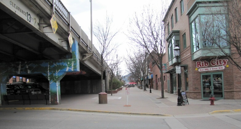 This bridge will also change our historic downtown area. The right-of-way between the buildings — not just the sidewalks — in the downtown area belongs to CDOT. In order to make this bridge meet minimum width requirements for four lanes — needed to carry between 24,000 and 30,000 vehicles per day — the new bridge will come closer to the buildings on both sides of our main street, an idea not well received by businesses and residents in that area.
Should our planning commission have seen this coming several years ago, and if so, could something have been done? Should this have been more directly addressed in our 2011 revision of our comprehensive plan? Probably. But we are working now to try to break down those silos.
Earlier this year I was appointed to serve on the transportation commission in addition to serving on the planning commission. It has been an eye-opening experience and I would encourage other planning commissioners to branch out and serve on other boards and commissions if that’s possible (and you have the endurance). Additionally, we are attempting to schedule more frequent workshops between these groups and increase communication between them.
Yes, the cowman and the farmer should be friends because, as the song says, “territory folks should stick together.” The same applies to the city planning commission, the transportation commission, and the governing body — as well as to other boards your municipality might have. We are all in this together. We all need to be on the same page, working toward the same goals, armed with a unified vision.
In an upcoming article, I will report on an exciting redevelopment project Glenwood Springs is embarking upon, The Confluence Project. This project has, thus far, been a collaborative (initially grant funded) effort between:
- a non-profit, The Sonoran Institute,
- a project advisory team consisting of representatives from various city boards and commissions,
- Garfield County,
- our local transit authority, Roaring Fork Transit Agency, and
- our transportation and design consultants.
Other citizen involvement has been and will continue to be encouraged. The project is in its infancy, but serves as a great example of multiple entities working toward a common goal.
I hope you will continue to join me as we explore small town planning issues and I welcome learning about how your city or town encourages collaboration between planning and transportation interests. Please add your thoughts on the PlannersWeb LinkedIn group page.
A Colorado native, born and raised at an altitude of 10,200 feet, Kathy Trauger has descended to an altitude of just below 6,000 feet to live, work, and play in the mountain oasis of Glenwood Springs, Colorado. A member of the Glenwood Springs Planning Commission since 2009, she currently chairs the commission as well as serving on the city’s Transportation Commission and other boards.
By day, Kathy works for Colorado Mountain College in the budget and finance office. Nights and weekends will find her blogging about opportunities and challenges in Glenwood Springs.

Notes:
- Sponsored by www.CommunityBuilders.net, a project of the Sonoran Institute, and presented by Jim Charlier of Charlier Associates, Inc. ↩
- Whit Blanton, “Integrating Land Use and Transportation,” PCJ #40 (Fall 2000) ↩