Reflections in Portland, Oregon’s Japanese Garden. Photo by Wayne Senville.
3. Transportation and Land Use
Over the years, we’ve published a number of articles highlighting the important link between land use and transportation planning. That’s something that’s very well understood in the Portland metro area.
Interestingly, what seems to be powering this linkage in Portland is an environmental issue: how to reduce greenhouse gas emissions to slow down global warming (aka, climate change).
As I reported in earlier posts (Wow, That’s Quite a Cut! and Distance, Destinations, Density), the Portland metro area has set very ambitious goals which would dramatically reduce greenhouse gas emissions over the coming decades. Meeting these goals requires a major change in our transportation patterns — more technically speaking, reducing vehicle mode share, while increasing mode share for transit, bicycling, and walking.
As you might recall from an earlier post, Portland’s streetcars are built in the Portland metro area. This streetcar is passing new market rate housing under construction in the city’s South Waterfront District
What’s strange, in a way, is that these challenging goals, instead of being a damper on economic growth, are actually strengthening the region’s economy.
You may recall both from my conversation with Nancy Hales of First Portland, and my report on Portland planning director Susan Anderson’s talk, that each highlighted how Portland and the metro area has embraced the rapidly emerging “green economy” — and has already benefited from this with new and expanding business opportunities.
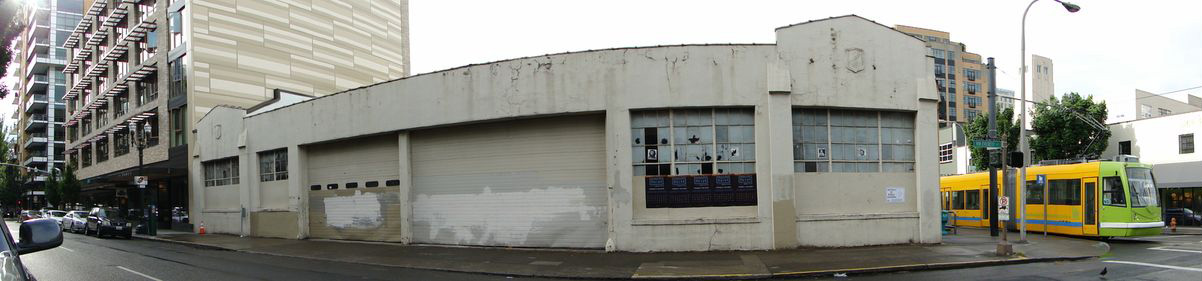
One of the relatively few remaining old warehouse buildings in the Pearl District will soon be replaced by a new nine-story, mixed-used building. See the design review notice below. The streetcar line has been key to revival of this large area close to downtown.
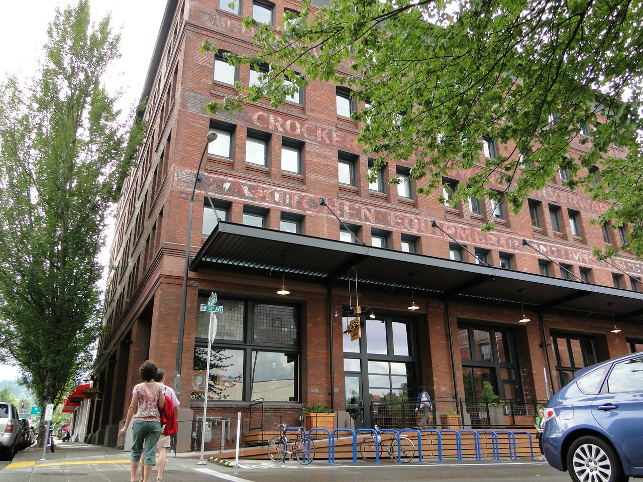
Many of the larger industrial buildings in the Pearl District have been rehabbed for conversion to apartments, retail, and office space.Over the course of less than 20 years, the Pearl District has become one of Portland’s liveliest areas. The Pacific Northwest School of Art is on the immediate right. New high-rise residential mix with rehabbed older buildings.Portland’s streetcar lines have proven to be the key to economic development in the Pearl District.
Portland’s streetcar line has helped fuel redevelopment in “the Pearl,” the city’s old warehouse district. The same is also happening in the city’s South Waterfront district. TriMet’s MAX light rail network has also helped support the growth of the “Silicon Forest” hub of technology in the region’s western suburbs (see my earlier post on Hillsboro’s Orenco Station development and its relation to Intel’s huge fabrication facility).
Yes, transit investments are costly. But so are building highways. Which is the better long term bet?
4. Dead Freeways
Yesterday, when talking about water and Portland, I briefly mentioned what led to the creation of Portland’s waterfront park. But it’s worth expanding on this a bit, as Portland has been one of the earliest cities to move towards the “end of the freeway” era. As Oregon-based editor and writer Sarah Mirk explains in Portland’s Dead Freeways:
“In 1943, Portland invited … urban planner Robert Moses to visit the Rose City and write its road construction plan. … His team holed up in a downtown hotel and whipped up an 86-page blueprint of Portland’s future, including our five current freeways plus freeways slicing throughout Laurelhurst, Sellwood and up Division.”
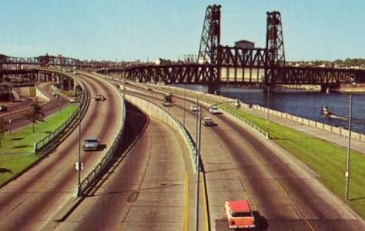
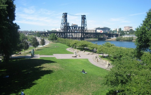
Postcard view of the now demolished Harbor Drive freeway in Portland, with a view of the Steel Bridge over the Willamette River. Compare to view of Harbor Drive’s replacement below: Tom McCall Waterfront Park. Photo by Rob Lambert, courtesy Flickr creative commons.
Then fast forward 25 years “when the state began buying up land to expand Harbor Drive [freeway] in 1968, Portlanders organized protest politics on the waterfront’s small strip of grass. Traffic engineers said closing the freeway would be a disaster, but citizens found open ears at City Hall and the Governor’s Office. They agreed Harbor Drive’s traffic could be rerouted to other freeways. In 1972, the 30-year old road was ripped out and replaced with a park.”
Portland and the Metro regional government have been national leaders in making the switchover from a roadway-oriented to a transit and alternative modes approach. With transit line extensions, Portland continues to take the approach that, “if you build it, they will come.” So far, ridership and new development along transit lines have, in fact, followed.
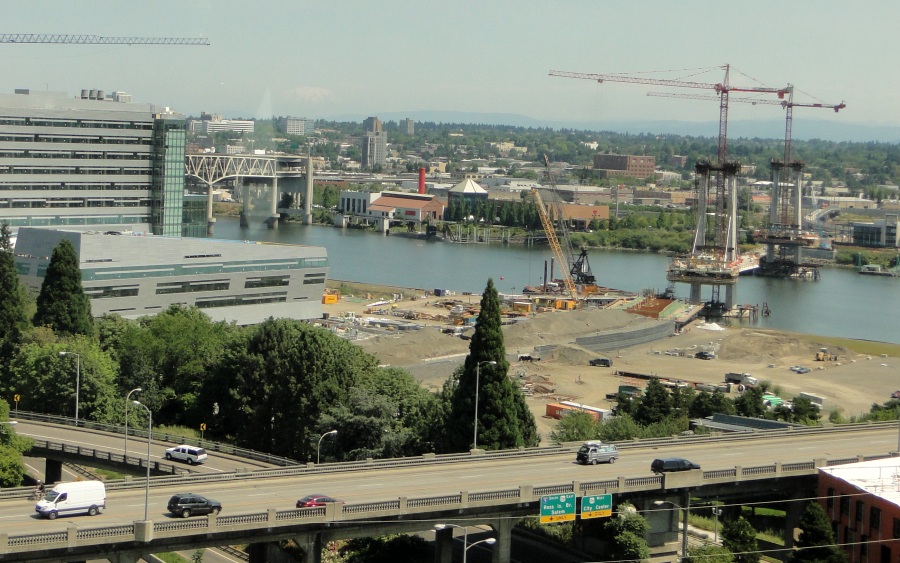
View from Portland’s aerial tram towards the Willamette River. The new “Caruthers Bridge” will host the 7.3-mile MAX light rail Orange Line when it opens in 2015. “Only trains, buses, streetcars, pedestrians and bicyclists will be able to use the bridge [and] it will be the nation’s largest no-automobile urban crossing,” notes an article in The Oregonian newspaper (Dec. 8, 2010), “The region’s extensive and growing bicycle network has also both created demand, and responded to demand.
Take a look at this amazing three minute video by StreetFilms of rush hour over the Hawthorne Bridge — which connects Portland’s east side neighborhoods with downtown.
Certainly cyclists have been strong advocates for more bicycle facilities. But as more facilities are built, more bicyclists seem to emerge — often people who just needed better bike facilities (and the sight of more people bike riding) to make them comfortable enough to also start biking more.
One of the next generation of Portland cyclists getting a free ride.