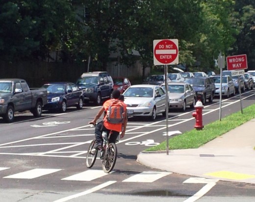
What can you do to make your city or town more appealing to bicyclists and pedestrians?
Acclaimed transportation researchers Rich Kuzmyak and Jennifer Dill in the recent TR News feature “Walking and Bicycling in the United States: the Who, What, Where, and Why” (May 2012) provide useful insights about key elements such as the following:
• Hills: A few people love the challenge of huffing up steep grades. But, a real-time travel survey of Portland, Oregon cyclists reveals the average bike commuter will travel more than 25% out of her way to find a route that is just one percent flatter. When creating your bike plan, try using three-dimensional mapping tools and advice from regular cyclists to assess whether the most direct route on paper is the most convenient one on the road.
• Climate: Acute weather affects even the hardiest traveler’s decision to bike or walk. Think about strategies to help people get out year-round, from snow days to dog days. Trees and awnings provide relief from the hot sun and a bit of protection from rain showers. In places where extreme weather is the norm, communities build covered walkways, Habitrail-style glass bridges, and underground tunnels for pedestrians and cyclists.
• Proximity: According to the most recent National Household Travel Survey (NHTS), almost nine out of ten walking and cycling trips lasted less than 30 minutes. The average pedestrian trip is about three-quarters of a mile, while bicycle trips average a little more than two miles. Compact, mixed-use communities boast consistently higher rates of biking, walking, and transit trips than places with far-flung origins and destinations – and, perhaps even more importantly in today’s economy, they are attracting more marketplace demand for housing.
• Connectivity: Studies comparing the high rates of walk/bike activity in Europe to the low rates in the U.S. found a key difference is many European communities provide well-connected, high-quality bicycle and pedestrian networks, while their American counterparts are plagued with “broken links.” When developing your plan, look for ways to provide walkers and cyclists a wide variety of convenient, interconnected, and well-maintained on-road and off-road paths that suit different needs and preferences.
• Design: In addition to providing routes that help cyclists and pedestrians navigate hilly areas, handle inclement weather, and steer clear of fast-moving cars, well-designed cities invest in traffic calming measures, adopt parking policies, and employ street lighting, landscaping, and crime-control strategies to make people feel safe and comfortable enough to roam around outside.

Assessing a Town’s “Deep Travel” Quality
As planning commissioners and planners, it’s our responsibility to create safe places that make people of all ages feel, as writer Tony Hiss puts it, “taken care of.” During his keynote remarks at the July 2012 American Planning Association Virginia chapter conference, Hiss shared the intriguing concept of “deep travel” from his newest book, In Motion.
The phrase “deep travel” captures the alert, fresh state of awareness you have during your first day visiting a foreign town. For just a few hours, you clear your mind of preconceived notions and open your senses to all that surrounds you, from the delectable to the detestable:
- the soft pink wash on the nubbly stucco houses;
- the mysterious red symbols on the wordless street signs;
- the stinging-sweet smoke curling from an old man’s pipe;
- the stinking, hot fumes billowing from the diesel buses;
- the happy shrieks of rambunctious children;
- the unsettling gaze of a teenage boy lounging on the corner.
How can the notion of deep travel help you make your town more appealing to bicyclists and pedestrians?
It provides a valuable counterpart to structured assessments such as the “walk audits” described in my Winter 2007 PCJ article, “Let’s Plan on Walking.” A walk audit is a great tool for assessing how well your community is addressing the key physical elements discussed by Rich Kuzmyak and Jennifer Dill. By putting on the imaginary shoes of a first-time visitor and taking a deep journey around your town, you can glean valuable insights about the essential qualities that make it a delightful — or dreadful — place for pedestrians and bicyclists.
Hannah Twaddell is President and founder of Twaddell Associates, LLC, a consulting practice specializing in community planning, public engagement, facilitation, and education. Based in Charlottesville, Virginia, the firm provides planning, facilitation, and educational services to communities, government agencies, and private organizations across the U.S.
Before setting up Twaddell Associates, Hannah was a Senior Transportation Planner with Renaissance Planning Group, where she has worked on transportation planning and public involvement projects in several states. Prior to that, she served as Assistant Director of the Thomas Jefferson Planning District Commission (in Charlottesville) and as chief staff to the Charlottesville-Albemarle Metropolitan Planning Organization.